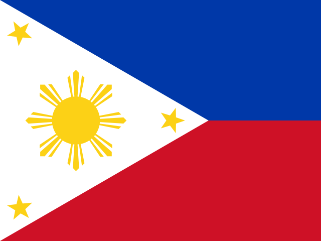
Manila — Capital of Philippines
Manila existed as a fortified settlement long before Spain arrived. Before Spanish colonization, the site on the mouth of the Pasig River was home to Maynila, a Muslim polity known as a rajahnate, ruled by local datus and already a significant trading port with connections across the wider Malay and Chinese trading world of maritime Southeast Asia.
Spanish conquistador Miguel López de Legazpi captured the settlement in 1571 and established it as the capital of the Spanish East Indies, building Intramuros, the walled inner city that became the seat of colonial government, the Catholic Church hierarchy, and Spanish military power in the archipelago for the next 327 years. Manila's location made it the eastern terminus of the Manila-Acapulco galleon trade, a Spanish trans-Pacific shipping route that, for over two centuries, connected Chinese and Asian goods to Spanish silver from the Americas.
The city changed hands twice more before Philippine independence took lasting hold: briefly to Britain during a 1762–64 occupation in the Seven Years' War, then to the United States following the 1898 Spanish-American War, which ended Spanish rule but replaced it with American colonial administration rather than the independence Filipino revolutionaries had already declared that same year in nearby Cavite.
Manila suffered catastrophic destruction during the Battle of Manila in February 1945, when American and Filipino forces fought house-to-house against entrenched Japanese troops to retake the city; the fighting and accompanying Japanese atrocities against civilians left much of Intramuros and the surrounding city in ruins and killed an estimated 100,000 Manila residents, making it, by the scale of destruction, one of the most devastated Allied capital cities of the Second World War alongside Warsaw.
Today the City of Manila is administratively just one of sixteen cities and one municipality that together make up Metro Manila, the sprawling National Capital Region — a distinction often lost on outsiders, since Manila proper is comparatively small and extraordinarily dense, while the wider metropolitan area, including cities like Quezon City (itself a former Philippine capital between 1948 and 1976) and Makati, forms one of the largest and most populous urban agglomerations in Southeast Asia.
Rizal Park, along Manila Bay, marks the site where Spanish colonial authorities publicly executed José Rizal, the writer and reformist whose 1896 execution helped ignite the revolution that led to the 1898 independence declaration and the flag's first raising; the park remains one of the most symbolically important public spaces in the Philippines and a frequent site of national ceremonies.
The University of Santo Tomas, founded in Manila in 1611 under Spanish colonial rule, is recognized as the oldest existing university in Asia under continuous operation, a reminder of how early and how thoroughly Manila was established as a major administrative and educational center of the Spanish colonial world, centuries before the revolutionary events that produced the modern flag.
Manila's Chinatown, in the Binondo district just across the Pasig River from Intramuros, was established by the Spanish in 1594 specifically to segregate and monitor the city's Chinese merchant community, and it is generally recognized as the oldest continuously operating Chinatown in the world, predating similar districts in San Francisco or New York by centuries. The city ranks among the most densely populated in the world, with well over 40,000 people per square kilometer in some districts, a density driven by Manila proper's small land area relative to the millions who commute into it daily from the wider metropolitan region.
San Agustin Church, completed in 1607 within Intramuros, is the oldest stone church in the Philippines and the only structure in the walled city to survive both the 1945 Battle of Manila and a series of earlier earthquakes and fires largely intact, earning it a place among the Philippines' UNESCO-listed Baroque churches. Manila Bay's sunset, framed by Roxas Boulevard and Rizal Park along the waterfront, is one of the city's most-photographed everyday landmarks, though the bay itself has also long struggled with pollution and periodic government-led cleanup campaigns aimed at restoring its water quality.
Quick facts
- Manila sits low along Manila Bay and the Pasig River delta, leaving it acutely exposed to the roughly twenty tropical cyclones that cross the Philippines in an average year, several of which flood the capital directly each rainy season.
- A one-way Manila-Acapulco galleon crossing typically took four to six months, making it one of the longest and most hazardous ocean trade routes of the age of sail and tying Manila's Chinese, Spanish, and Mexican merchants together for over two centuries.
- Manila's jeepneys, the brightly decorated public transit vehicles still filling the capital's streets, trace back to US military jeeps left behind after the Second World War and refitted by local mechanics as passenger transport.
- Fort Santiago, the citadel guarding Intramuros' seaward corner, held José Rizal in the days before his 1896 execution and today houses a shrine and museum inside the fort's original Spanish-era walls.
- Quezon City, now part of Metro Manila, briefly served as the Philippines' official capital from 1948 to 1976 before the title reverted to Manila.